This pandemic is running for too long. In our home we all feel a growing desire to move, travel, see places, learn new things…. and adding this to this dad’s passion for airplanes…. well, we got ourselves an idea for a different kind of class! We decided to do a virtual flying tour! Our eldest daughter, Lara, who is 5-and-a-half, was really up to it as well.
So I spent a couple of days brainstorming and planning a few things and eventually settled in a trip to learn about the Azores archipelago, one of two archipelagos of Portugal.
In this first visit I picked the central group of islands, which is the one where the islands are more close together, which is great since we don’t want the trip to take too long (2hrs max).
But don’t be fooled, the plane ride is really a platform to learn about history, geography and so many things about these islands and our world. 🙂
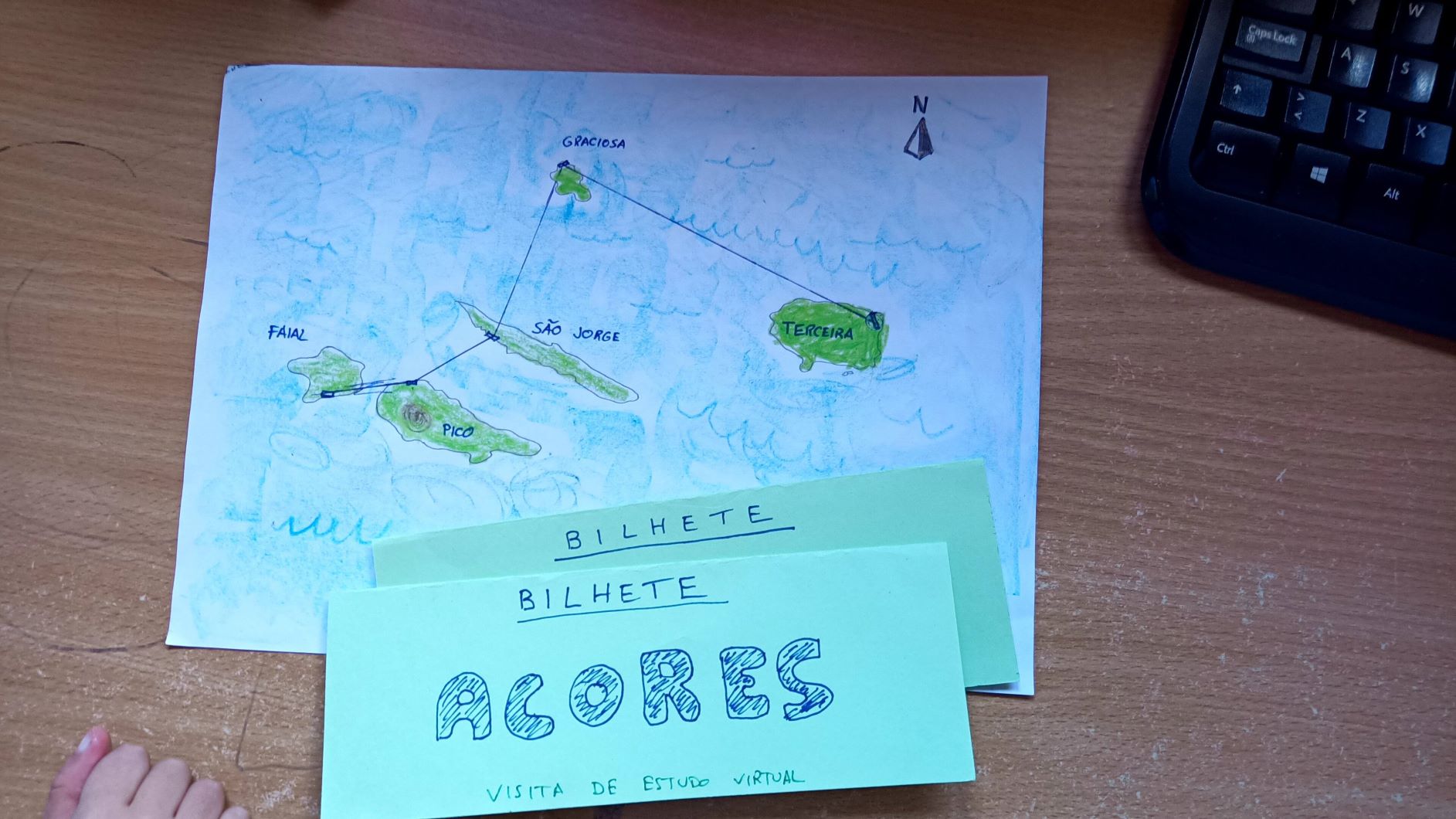
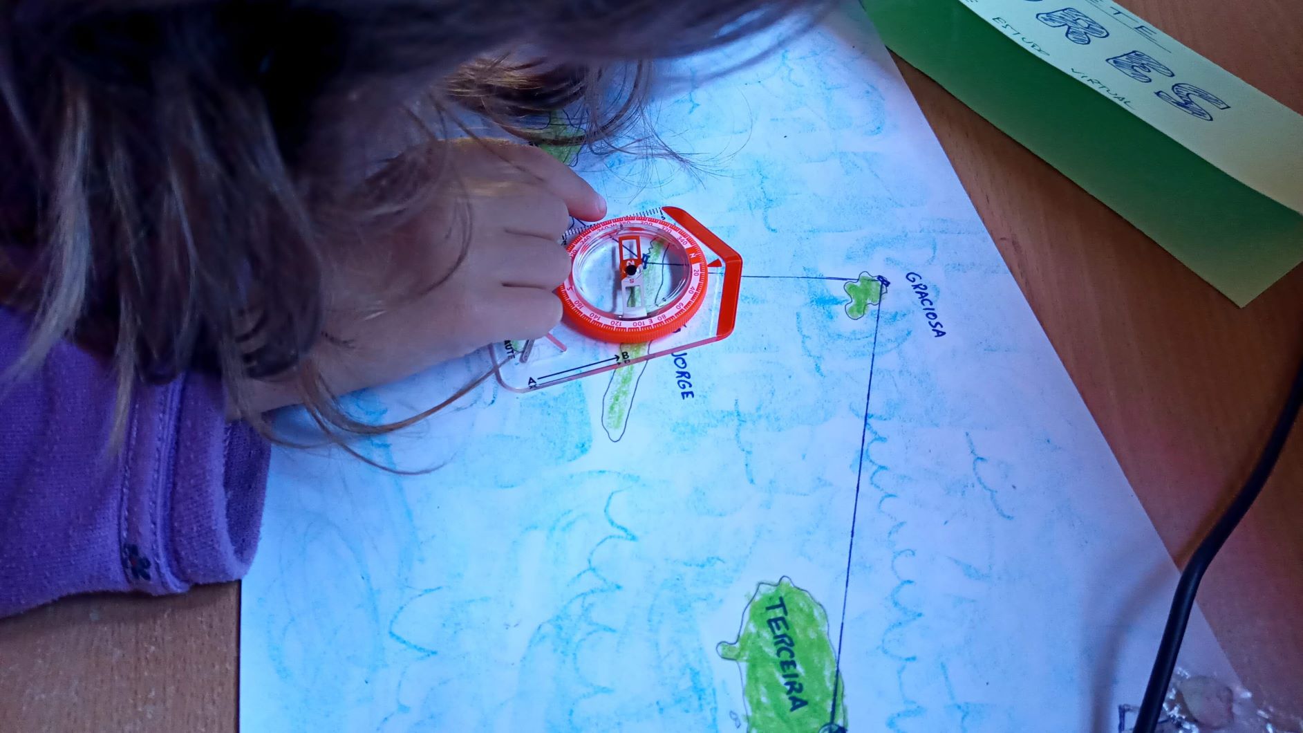
On the eve of our trip I tried to print a map of the islands and the itinerary to follow. But as you might expect, a true printer will never print when you actually need. So forget the printer! We picked up our coloring pencils and made a map ourselves!
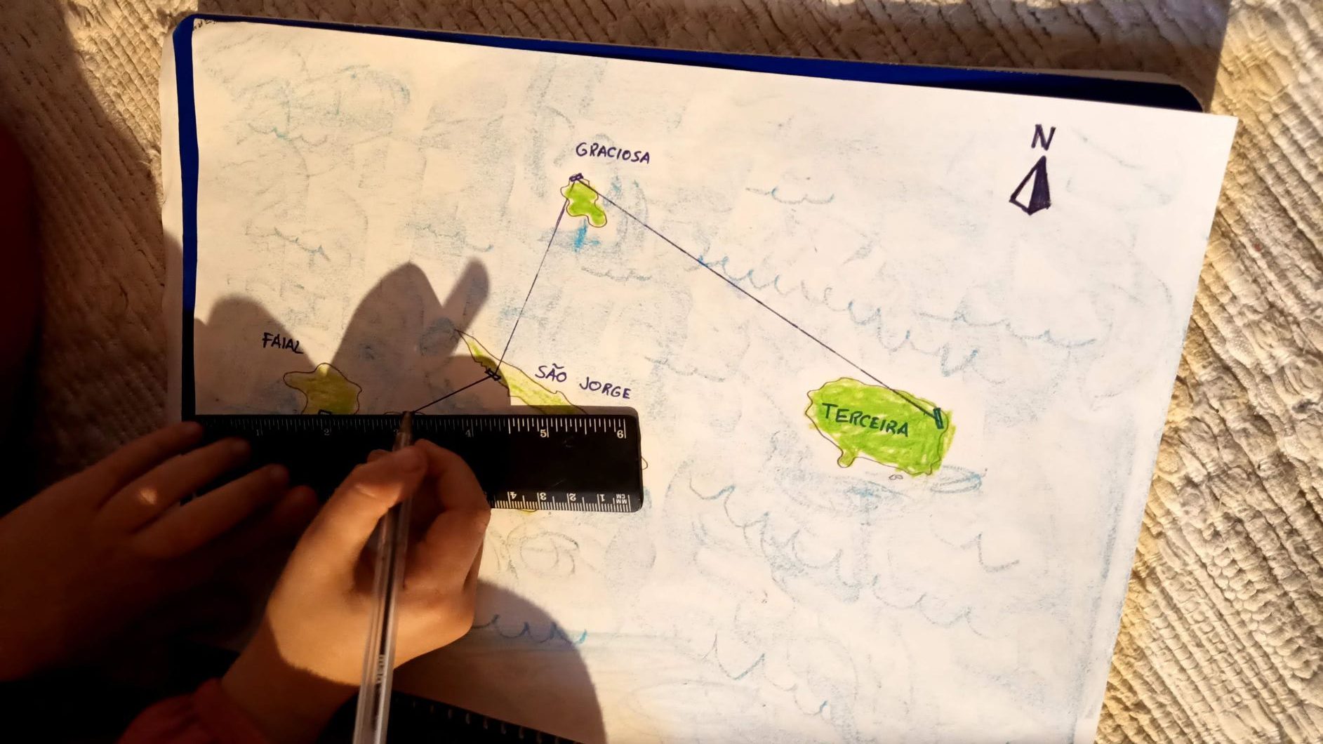
Lara chose the sequence we would fly: departure from Terceira, follow north to Graciosa, go down to São Jorge, Pico and finish in Faial
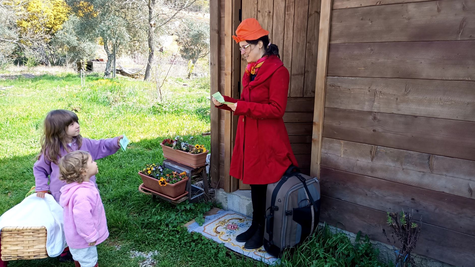
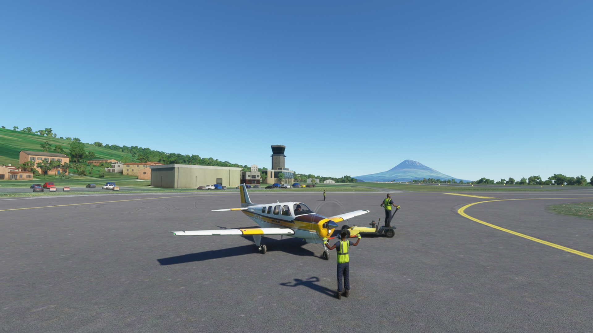
Finally the day came! During the morning the conversations were mostly around the trip we would be doing in the afternoon. So at this point I thought we need to make this even more fun and do some role-play as well!
I made some paper tickets so that this felt like a real trip. I hid one walkie-talkie in the living room, and once in a while I hid somewhere and made some radio announcements regarding boarding times 😂 I don’t even know who is having more fun, me or the kids? ah!
My wife played along and improvised some clothes to look like airport staff and checked the tickets during boarding. Now we are a real airline!
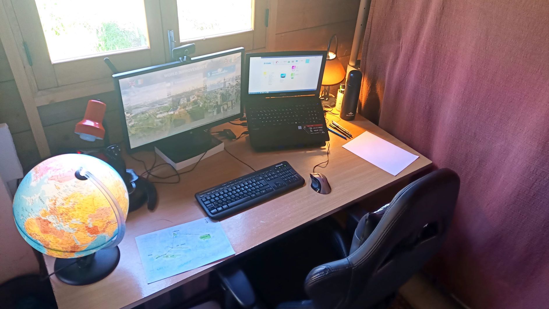
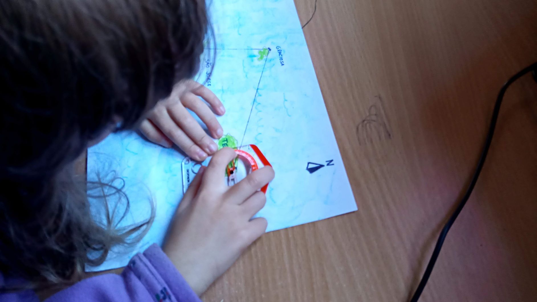
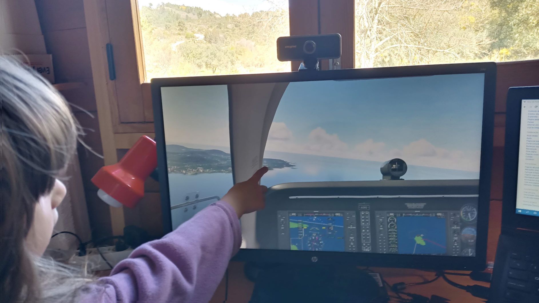
After we all boarded, we set up our equipment, maps and, of course, Lara’s compass! Yes a compass, because this trip won’t have any modern GPS or other navigation aids, we will do it in the old fashioned way following a map and a compass, especially because Lara likes numbers and has been learning about angles lately.
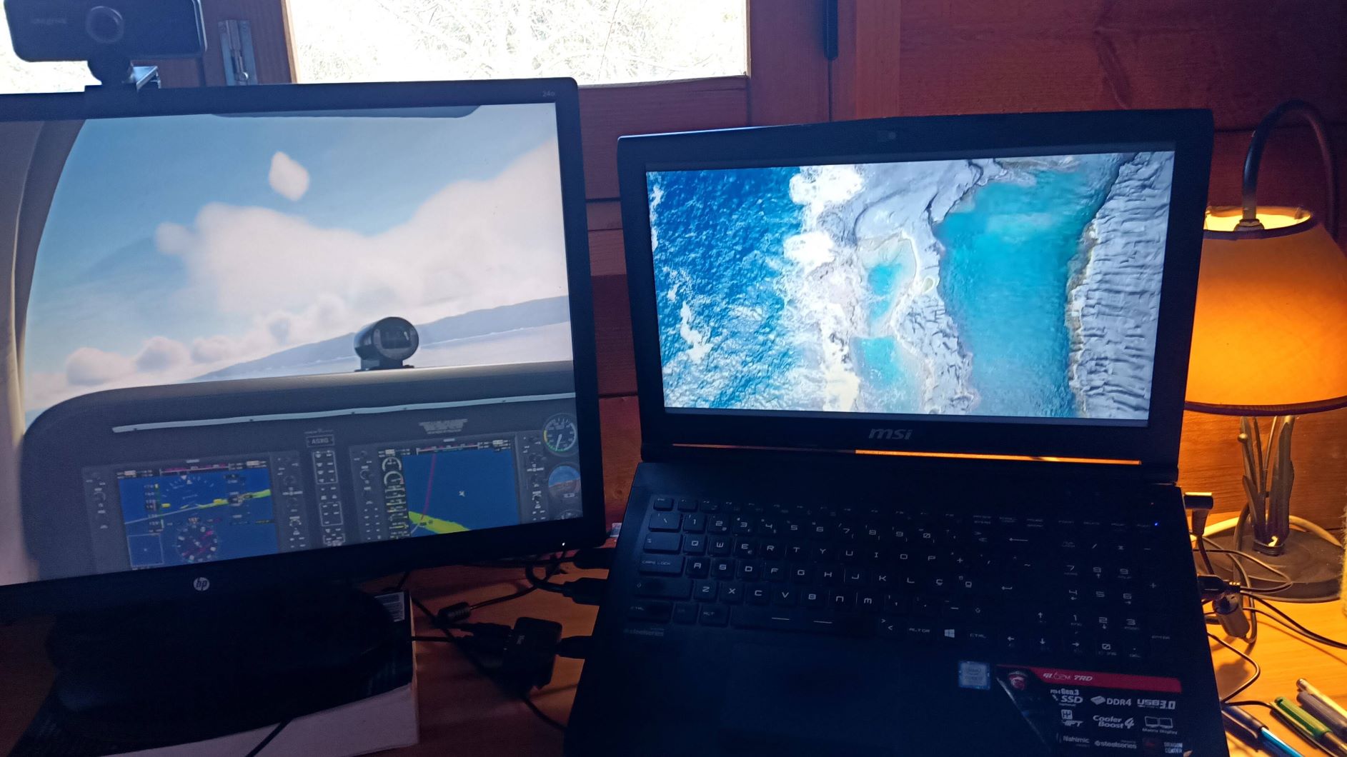
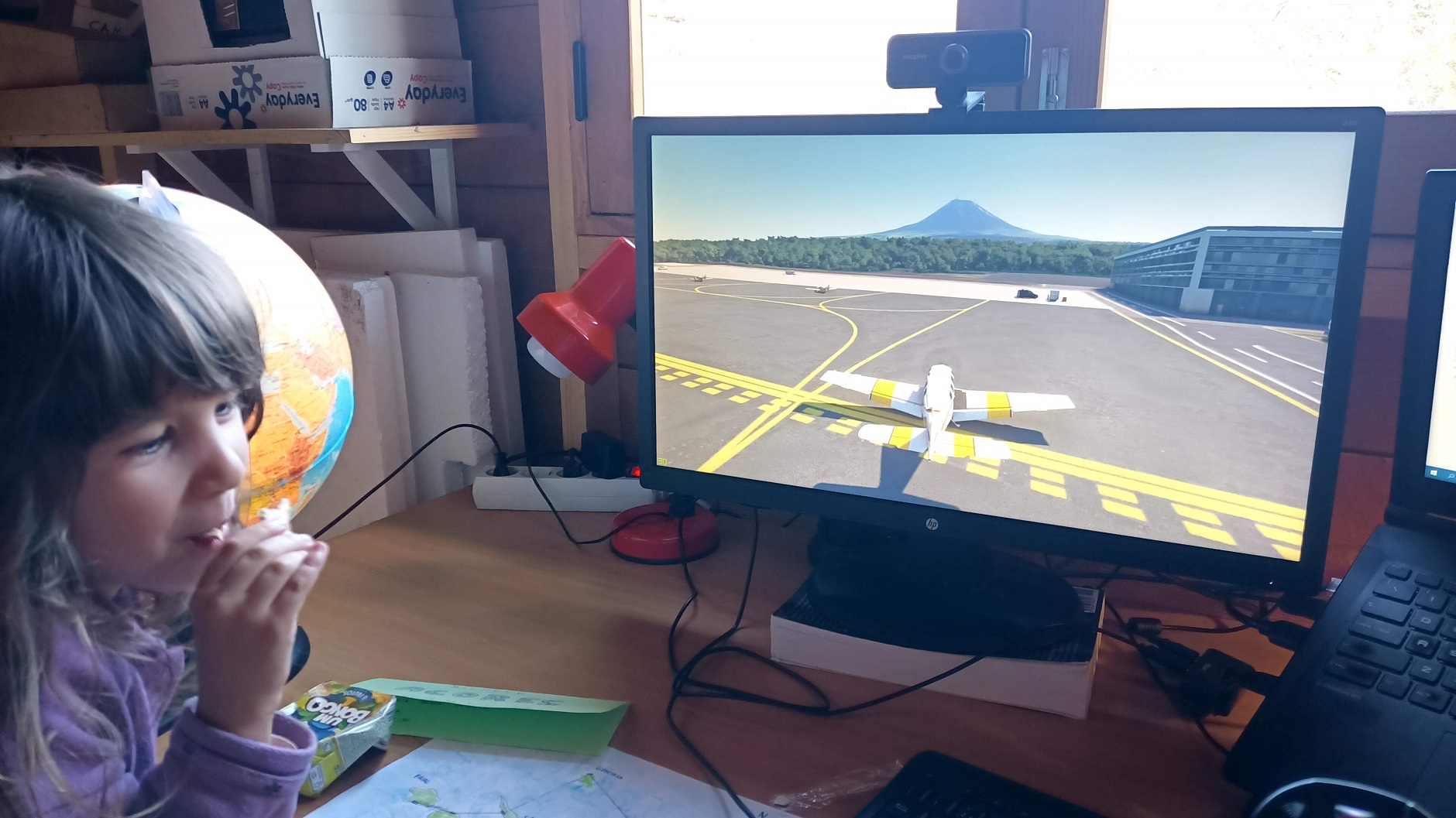
Next to our main screen we have a secondary screen with wikipedia (and other websites) which will provide us with information and knowledge about the places we go to. Oh, and Lara’s globe lamp is also here so we can have a really broad view of where we are flying in planet earth 😃
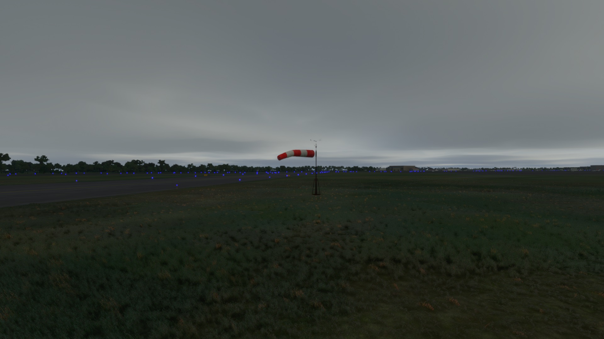
In case you don’t know, the weather in Azores is really unpredictable and unstable. We were expecting a sunny day but we faced some clouds and lots of wind. But even that was good. Here at home we have been trying to build a paper kite, and one of these days I said we need to build a windsock to help us fly. Windsock? What is it? How does it work? Luckily, airports have plenty of windsocks, so we go and check it out before starting the plane’s engines. A windy day is a good demonstration for a windsock! Now we have a better understanding of what we need to build as well!
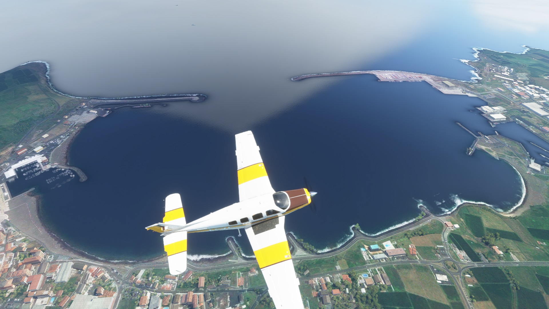
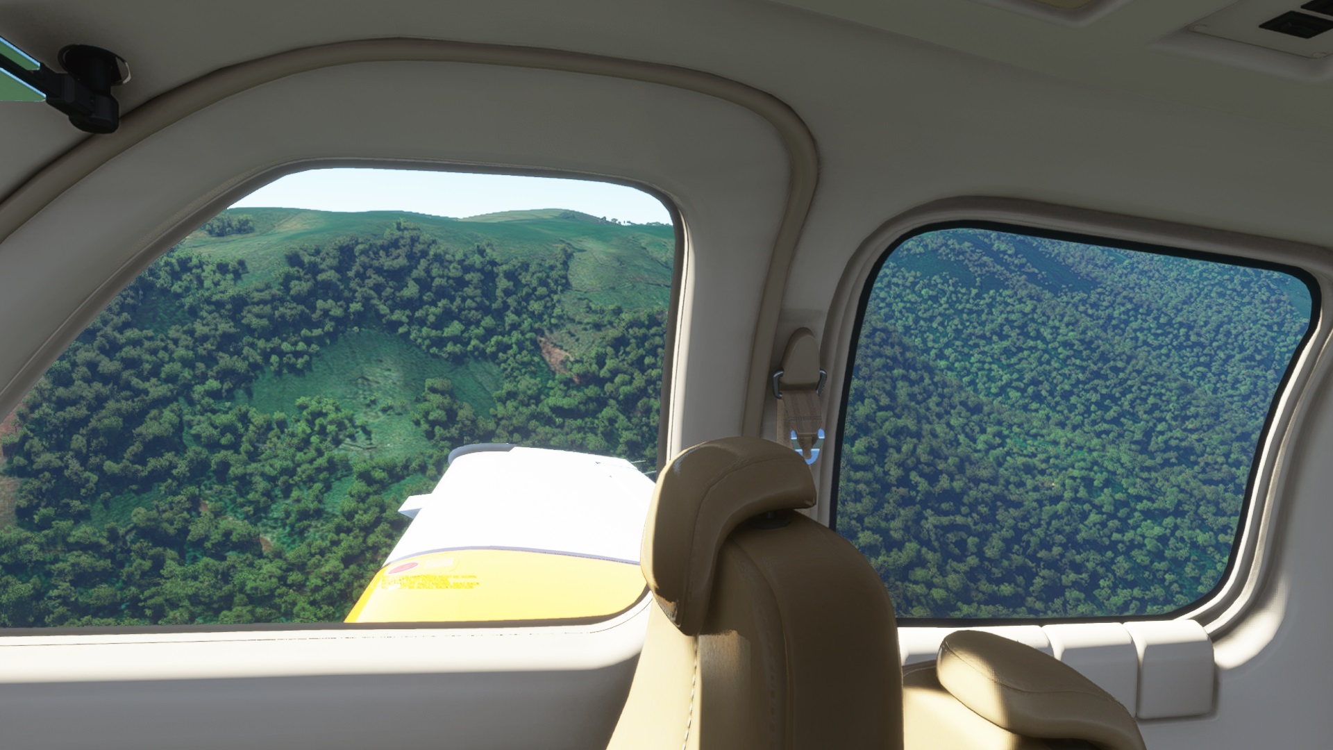
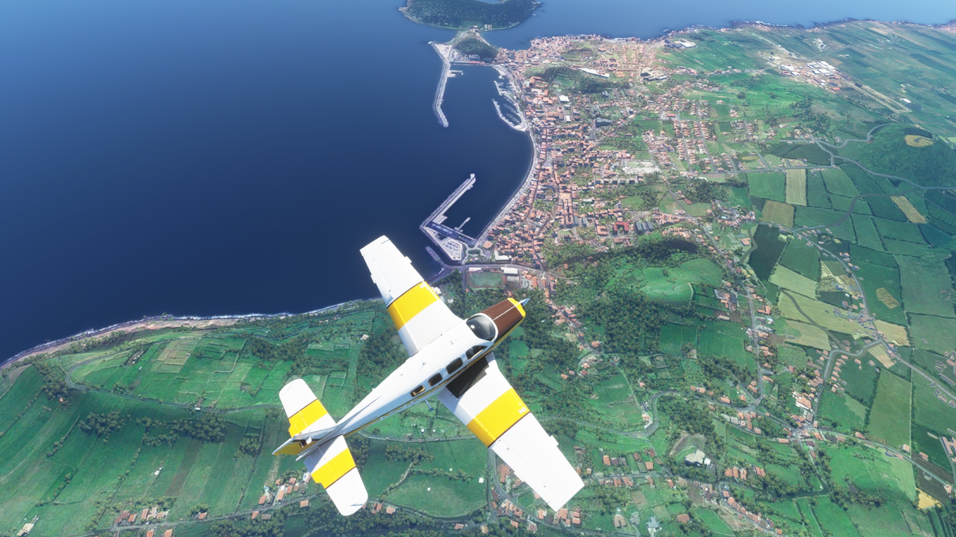
As we spend some time talking about the country, the Azores, the island of Terceira, the weather also improved and we got a clearer sky for the rest of the journey. After we took off, Lara learnt what are marinas and ports, what are they used for, and why there are so many in the Azores.
After a shourt tour on the island, we need to get moving because our journey is a long one. Next stop: Graciosa island. For that, we now put the compass to work in order to figure what the heading to follow. Let’s hope we don’t make a mistake or we will end up lost in the middle of the atlantic.
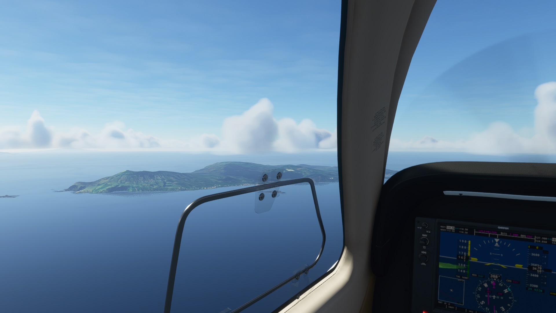
About 10 minutes in we have visual contact with the island of Graciosa. I guess the compass did work and our navigation was correct!
Here we read about lighthouses, something that Lara has heard about but doesn’t remember quite well what it is or what it is for, so we explore a bit more on that topic.
As we approach the airport where we should land, Lara identifies the runway.
Quick enough we are back to our map and compass, checking how to go south towards the island of São Jorge. While we fly amongst the clouds, we read and watch a few interesting things about this island. We ended up with a very cool youtube video that shows a lot of beatiful parts of the nature in São Jorge.
Check it out as well:
https://www.youtube.com/embed/PKkVt8kmvBU
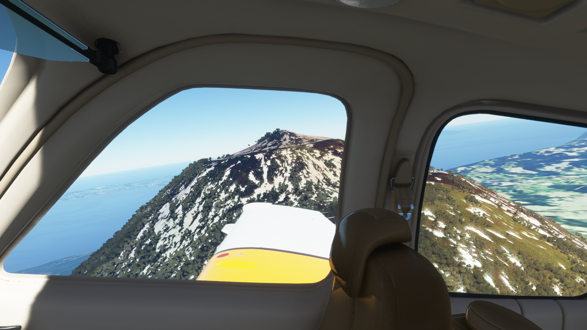
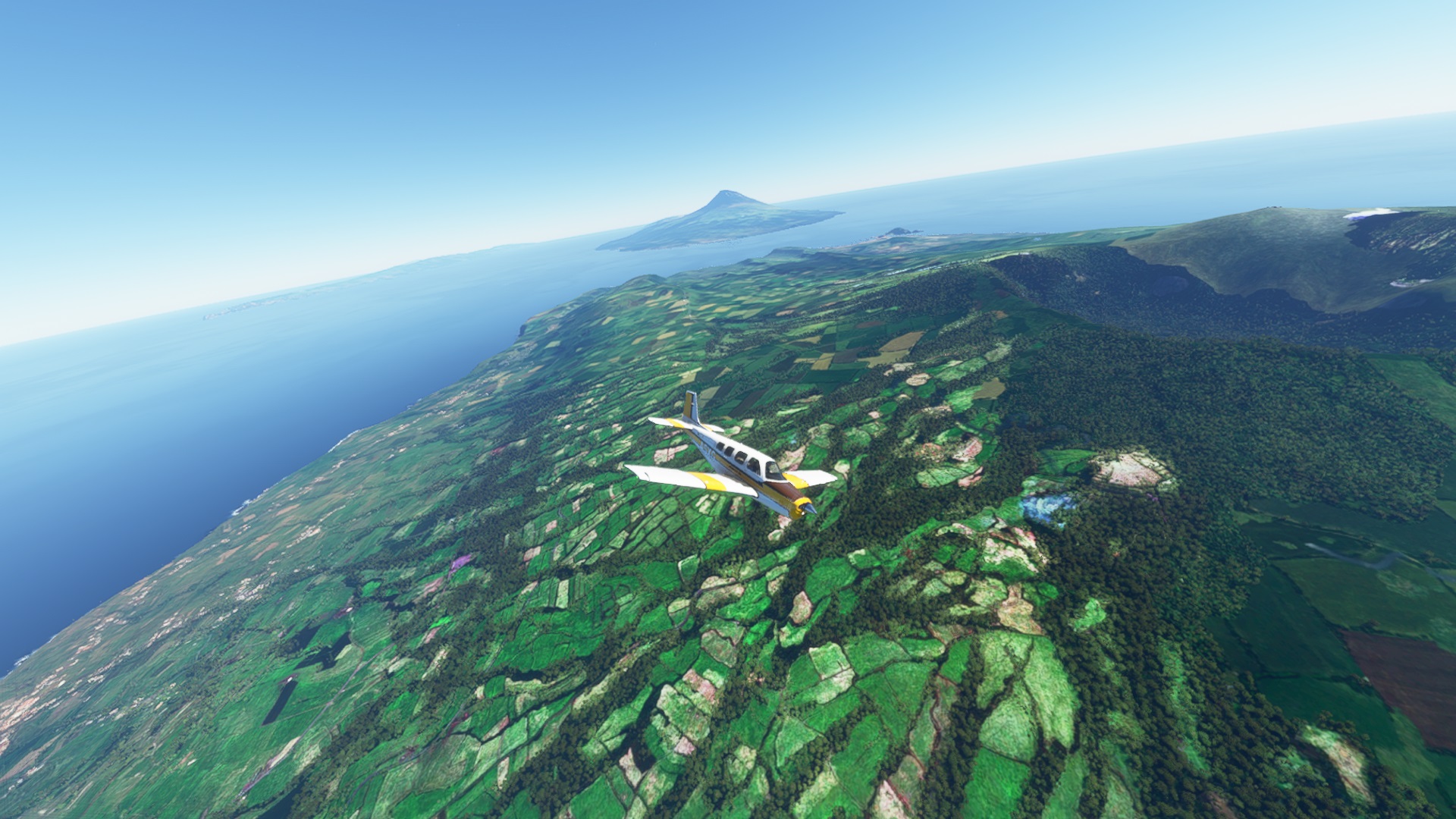
We also read that the north side of the island is characterized by a tall mountain range near the shore. And it is indeed! As we approached we were faced with the tall vertical wall that we struggled to climb, so we thought it would be better to turn east and go around it.
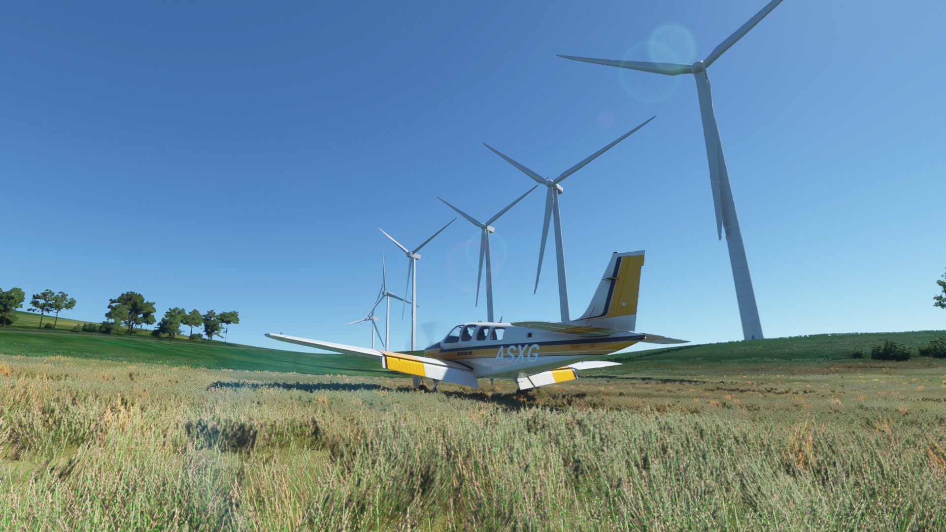
After we went around and started flying towards the airport, Lara noticed something interesting up there in the mountains! What is it?
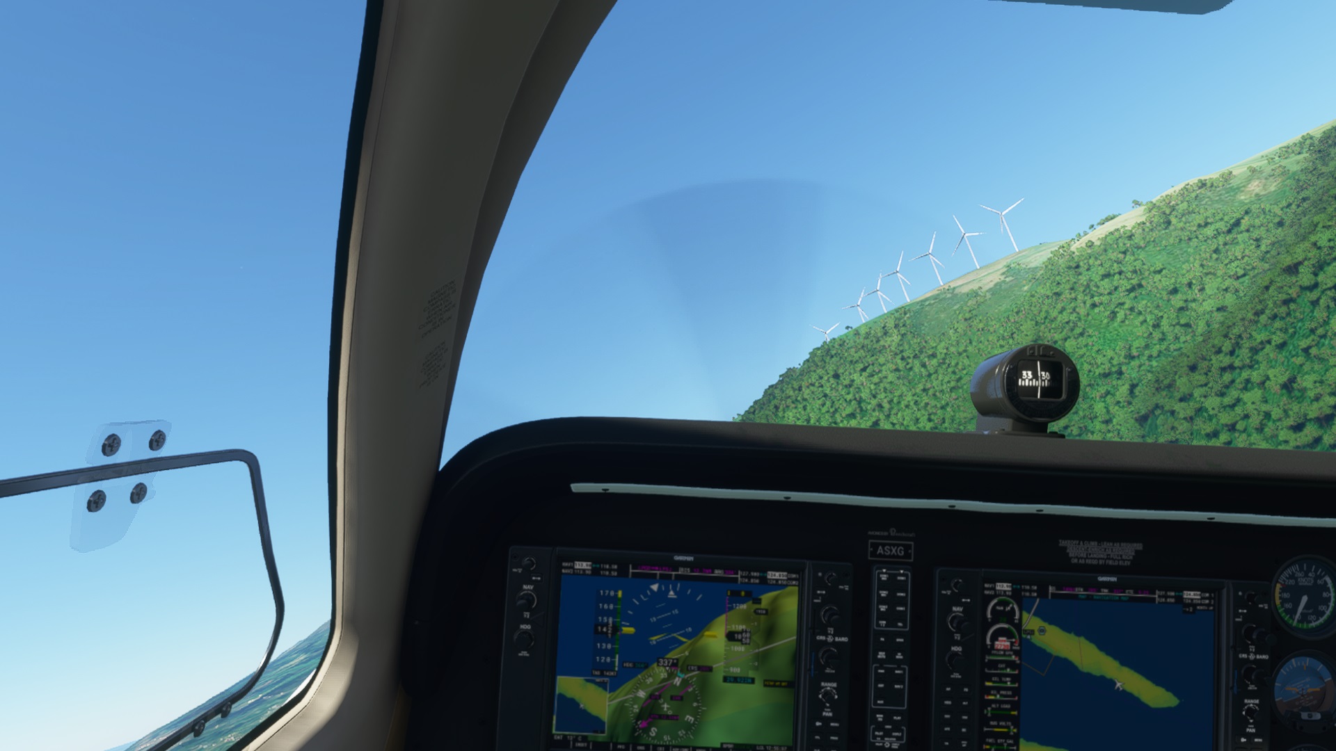
Oh, those are wind generators, just like we have here near our mountains. They are one of the main sources of energy in Azores.
Not a coincidence, we also learnt about many old fashioned windmills still standing in the islands. I guess its the ancient way of harvesting wind-energy, electricity free!
But Lara wanted to check it out closer, so we looked around for a place to land, and managed to take a really good look at it. While we stopped we got to talk a bit about how a wind generator works.
Back in the air, and with the wind generator park far behind us, we get to experience how long and narrow this island is (it is the longest island in azores!).
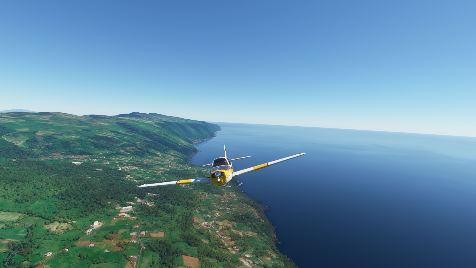
Finally we landed and made a quick stop to refuel. Looking to the south of the island, we can already see one of the main attractions of this trip across the sea.
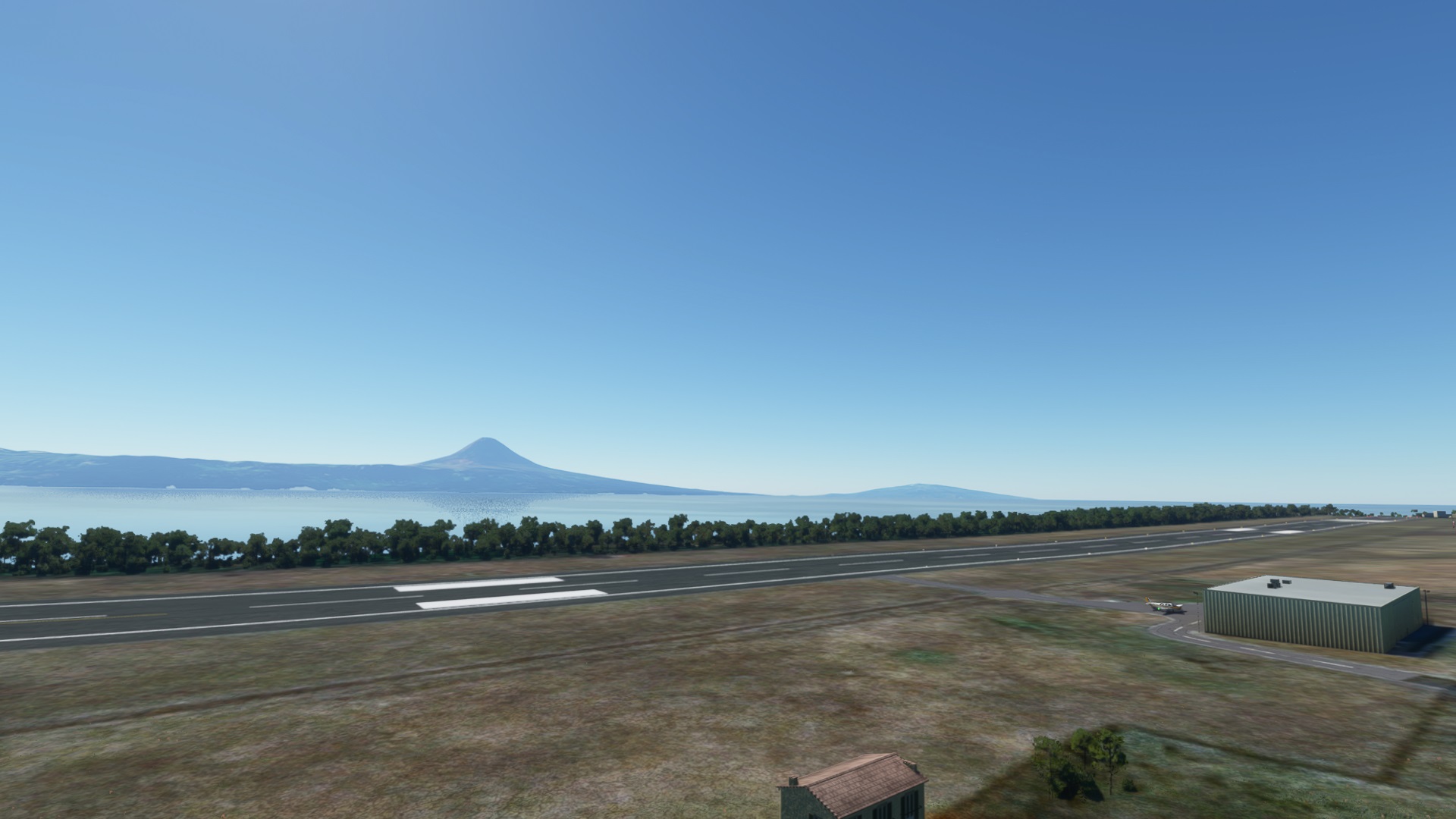
Ready for take-off towards Pico island. With this nice weather we can see it from afar!
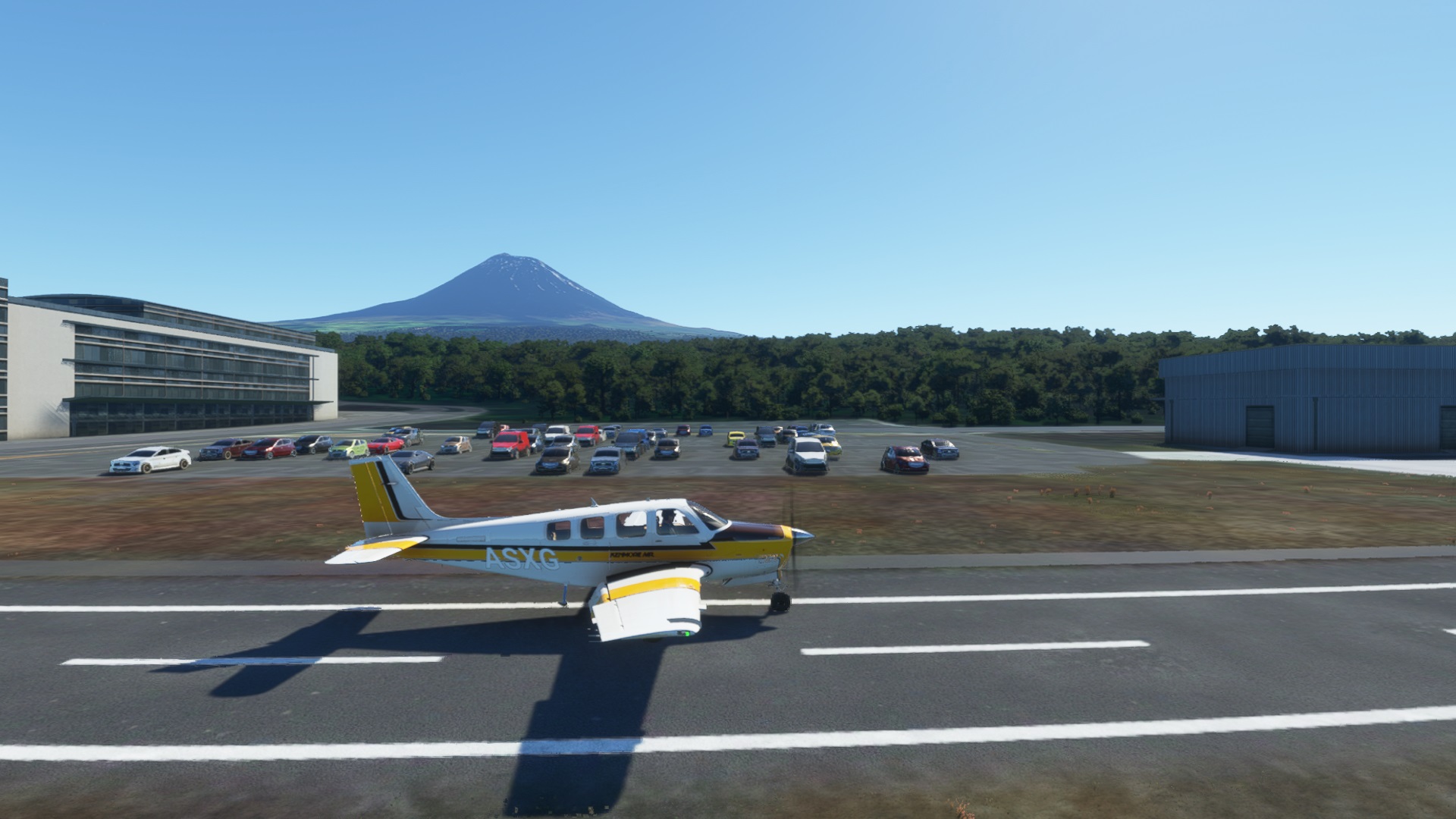
We live near the highest mountain range in Portugal, but actually it is not the highest if we consider the islands. Pico, which was a volcano is THE highest mountain in the whole of Portugal. And the fact that it is a volcano makes it far more interesting to learn about 🌋 We took this opportunity to check a comparison chart of the highest mountains in Portugal

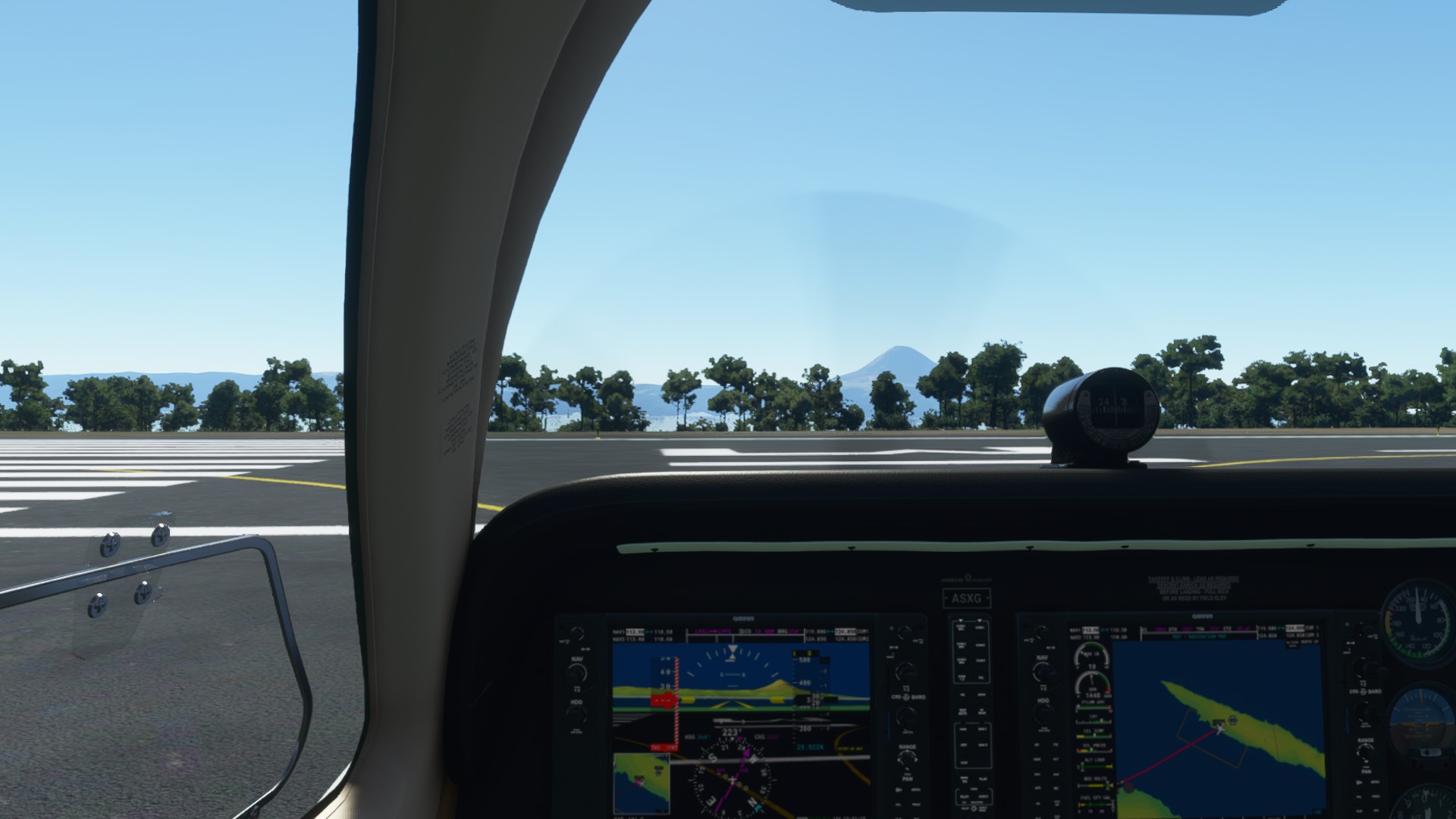
We barely made it, but fortunately our plane was strong enough to make a good climb so we could take a peek at the top and learn that volcanoes also extinguish and then “close” when the lava melts.
After going around and checking the volcano, we landed in Pico airport to rest and have a snack! (Yes, because this airline is so cool that offers free snacks!). And we snack with a new view to the mountain 😃
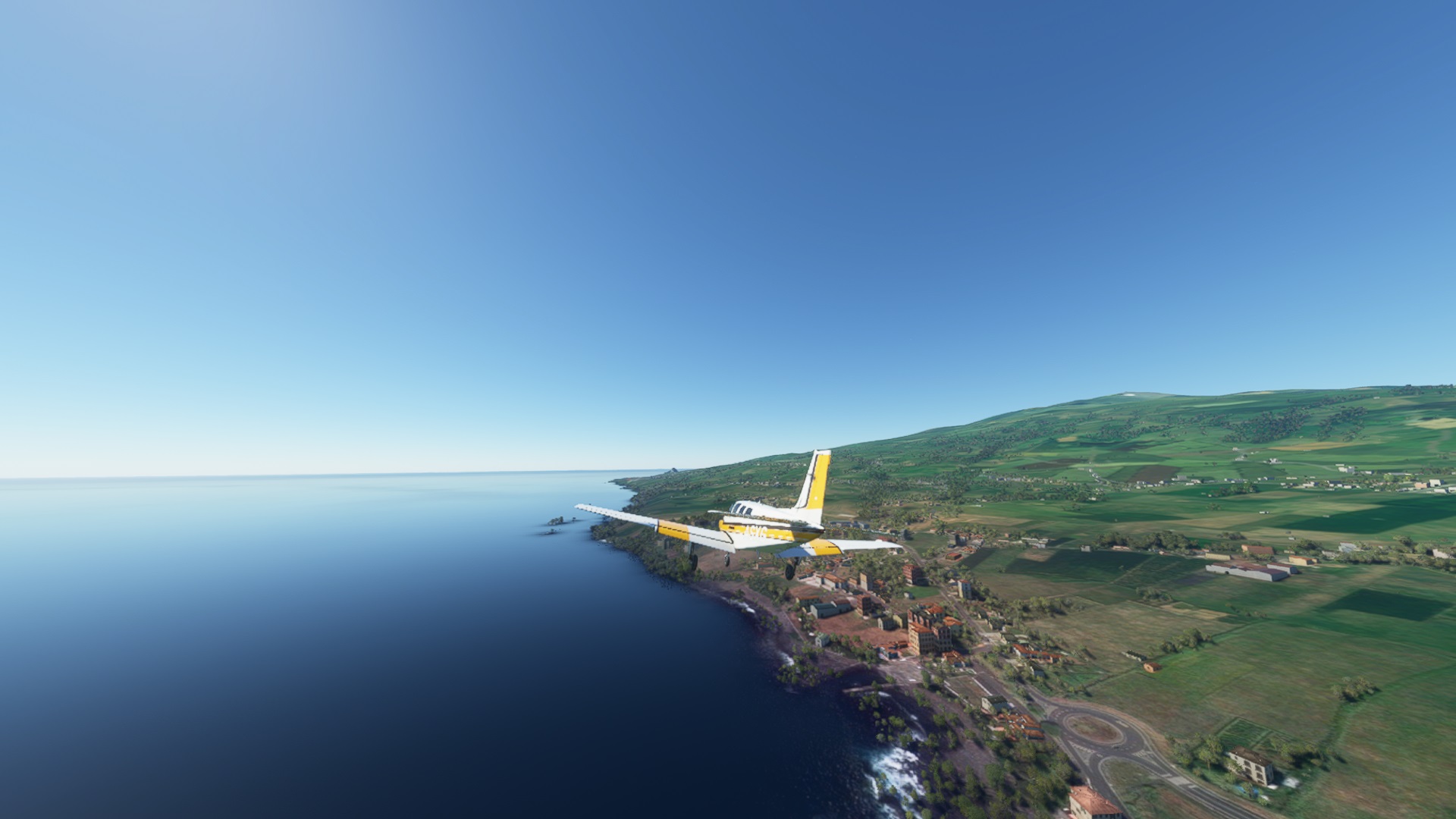
We took off towards our last island: Faial! Because it is so close to Pico the trip was very fast. We got into the island coming from the East, right above the main city of Horta (which gives the airport it’s name). One of the most important cities in Azores, also with a big port and marina.
Here we got to know that Faial island also has its own volcano, with a very beautiful scenery inside it. So of course we had to check it out and take a picture with two volcanoes at the same time 😎
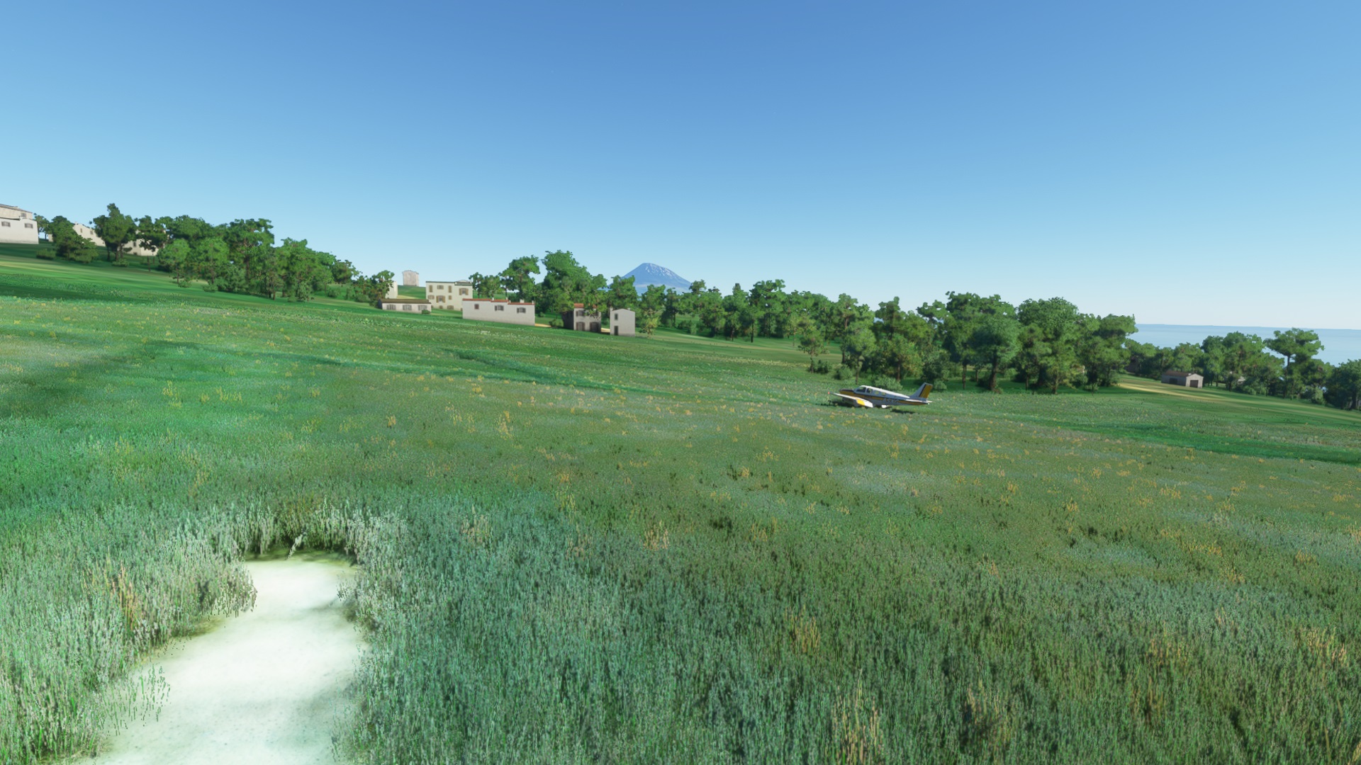
This visit to the second volcano messed up our navigation plans, so we had to go back to Horta, turn-around and get aligned again with the runway. But because our trip was coming to a close, Lara wanted to see the ground once again and so we found a nice empty field with the famous lush-green grass of azores 🐄
And finally, we approach the final airport: Horta.
And so ended our journey, after around 1h30m, plus boarding time 🧳😁
After this we brainstormed so many ideas of places we could visit and learn about, but unfortunately my laptop is too old to be able to visit them. I’m already quite lucky that it can even run this game at all 😅